
| BAHS Home | Photo Collection |
|
|
Commonwealth
Avenue East
Warren St to the Back Bay Information on the early history and construction of Commonwealth Ave is found on the BAHS Comm Ave West page.  1875 Map (plate L) with Washington St on the left and Warren St in the center. Comm Ave at Warren St would start out approximately where Breck St meet Warren.  1885 Map (plate L) that includes the plan for Comm Ave when it was called Massachusetts Ave  Lorraine Terrace at 153 Kelton St just off Comm Ave.  1387 Comm Ave at Allston St  1384 Comm Ave on the eastbound side at Allston St  1315 Comm Ave at Long Ave 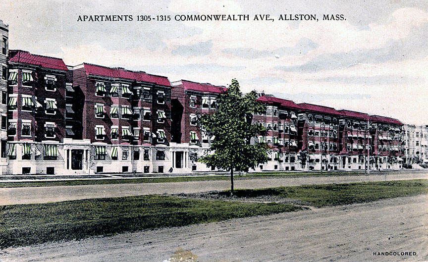 1305-1315 Comm Ave between Long Ave and Spofford Rd  Hotel Princeton at 1277 Comm Ave next to Spofford Rd  Capitol theater at 1266 Comm Ave at Gorham St in 1932. <click here> for more information.  Comm Ave looking east towards Harvard Ave in 1916.  1909 Map of Comm Ave between Allston St (left) and Harvard Ave (right) that shows that much of Comm Ave was still undeveloped at this time.  Comm Ave looking west from Harvard Ave  Close up of the previous photo  1251 Comm Ave west of Harvard Ave  1251 Comm Ave  1226 Comm Ave at Harvard Ave  A later photo (c1930) of the above building at 1226 Comm Ave with the additions of storefronts and Cafe Boulevard. (courtesy of Sandra Swaile)  Postcard of the Boulevard Cafe  Comm Ave at Harvard Ave looking towards Brighton Ave. (Courtesy of Joel Shield)  Comm Ave at Harvard Ave 1938  1222 Comm Ave at Harvard Ave  Comm Ave at Linden St  Comm Ave at Linden St (Courtesy of Joel Shield)  1114 Comm Ave near Fuller St and Packard's Corner  1127 Comm Ave near Packard's Corner  Corner of Comm and Brighton Ave (courtesy of Joel Shield) AUTO MILE The headquarters of the auto industry
in Boston for over a half century was the
so-called Auto Mile which was that portion of
Commonwealth and Brighton Avenues lying between
the B. U. Bridge and Allston’s Union Square. The
founder of the Auto Mile was the fascinating Alvan
Tufts Fuller (1878-1958), a native of Malden,
Massachusetts, who was a major figure in both the
business and political history of
Massachusetts. After traveling to Europe in
1900 to investigate the fast-growing auto industry
there, the ambitious entrepreneur persuaded the
Packard Motor Company of Detroit, Michigan to make
him its exclusive dealer in the Boston area.
A year later he added a Cadillac agency to his
dealership. In 1908 Fuller decided to move his
growing dealership to an undeveloped tract at the
intersection of Commonwealth and Brighton Avenues
in Allston, a location known, by strange
coincidence, as Packard’s Corner, having been
named for a well-known stable and riding school
run by John D. Packard located at 25 Brighton
Avenue. At this Packard Corner location Fuller
established the first combined auto salesroom and
service station in New England. The massive
facility comprised a sales salon and offices at
the ground level, with the remainder of the
building providing assembly, storage, and repair
facilities.
Even at the depths of the economic downturn, in 1932, the Auto Mile was home to no less than fifty-four car dealerships specializing in a combination of new, used, and commercial vehicles, dealerships selling all of the following makes, many of which no longer exist: the Auburn, Cord, Oldsmobile, Ford, Hupmobile, Cadillac, Franklin, LaSalle, Pontiac, Chevrolet, Chrysler, Plymouth, Reo, Nash, Buick, Packard, Pierce-Arrow, Rolls-Royce, Studebaker, and Stutz. The most memorable of the many innovations that Alvan Fuller initiated were the open houses that his Packard Motor Company hosted annually on Washington’s birthday, giving customers an opportunity to view the latest models and to plan future car purchases. The Auto Mile went into rapid decline in the late 1970s as many dealers moved their establishments to more accessible suburban locations. <click here> for more information on Alvan Fuller and the Auto Mile.  Packard dealership at 1709 Commonwealth Ave built by Alvan T. Fuller in several stages between 1909 and 1930.  The Packard building in 1940 has expanded to the right from the original building above (Courtesy of Historical new England)  1922 Packard  Packard Ad in the 1923 Boston Globe  Packard Ad  Intersection of Comm and Brighton Ave c1960. Note DeMambro Electronics at 1095 Comm Ave which closed around 1970. This was the company's headquarters which opened in 1953 and was the largest electronic parts distributor east of Chicago at that time. The Packard building on the right in c1960 has become the home of the Clark and White Lincoln Mercury dealership. Today it houses condominiums.  View of Packard's Corner looking west in 1930. The sign on the Packard building advertises a price of $2275 for a Packard.  Commonwealth Chevy at 949 Comm Ave c1920s  Commonwealth Chevy at 949 Comm Ave. Note the phone number on the door.  Commonwealth Chevy at 1065 Comm Ave 1930. This is now a Star Market.  Interior of Commonwealth Chevy at 1063 Comm Ave (Courtesy of Boston University)  Coombs Ford at 996 Comm Ave c1960 (courtesy of Boston University)  Herb Connolly Buick at the corner of Comm Ave and Babcock St  Ellis the Rim Man store at Comm Ave and Babcock St c1960  The Allston Golf Club House established in the 1890s where BU's Nickerson Field is today. <click here> for more information.  Braves Field in 1933. Comm Ave is at the top and the Armory on the left. Braves Field was the home of baseball's National League's Boston Braves from 1915 to 1952. The Braves moved to Milwaukee in 1952 and then onto Atlanta. Today it is the site of Boston University's Nickerson Field. <click here> for more information.  Trolley servicing Braves Field next to the Armory on Comm Ave  The Commonwealth Armory was a Massachusetts Army National Guard armory. It was built at the intersection of Harry Agganis Way and Commonwealth Avenue in Boston, Massachusetts in 1914-1915. It was demolished in 2002 and replaced by BU's Agganis Arena in 2004.  Pontiac Village in the 1960s at 860 Commonwealth Ave  Noyes Buick at 855 Comm Ave in 1930s  Interior of Noyes Buick  BU's College of Fine Arts is now housed in the building that was Noyes Buick  Howard Johnson's next to the BU Bridge on Comm Ave (courtesy of MIT)  Howard Johnson's at the BU Bridge at Comm Ave  BU bridge in 1930. At this time it was called the Cottage Farm bridge. The name "Cottage Farm" derives from the then popular English Cottage style of building and associated lifestyle of genteel country living. The Brookline area opposite the bridge was called Cottage Farm. The building at the bottom was a Ford Assembly Plant on Memorial Drive  A more recent photo than the one above showing Storrow Drive, which was built in 1951, that now goes under the BU Bridge.  This building was known as Peter Fuller's Cadillac Olds opposite the BU bridge. Peter was the son of Alvin Fuller. It is now owned by BU.  Nash dealership at 640 Comm Ave (courtesy of Boston University)  Nash Rambler Ad from 1913  The Nash dealership building is now BU's College of Communication  Comm Ave looking west in 1925. Kenmore Sq would be in the bottom right. Cambridge is on the right  Close up of the above photo. Note the bridge on the top which preceded the current BU bridge structure. The bridge on the right no longer exists and seems to be an extension of St Mary's Street. Note how undeveloped Comm Ave is in 1925 where the BU campus is today.  Comm Ave looking east from near the BU Bridge (Courtesy of Boston University) Boston University History Between 1920 and 1928, Boston
University bought 15 acres of land that had been
reclaimed from the river by the Riverfront
Improvement Association. Plans for a riverside
quadrangle with a Gothic Revival
administrative tower modeled on the "Old
Boston Stump" in Boston, England were scaled back
in the late 1920s when the State Metropolitan
District Commission used eminent
domain to seize riverfront land
for Storrow Drive. This campus plan was never
realized, but BU's fourth president, Daniel
L. Marsh, led a series of fundraising campaigns
(interrupted by both the Great
Depression and World War II) to
gradually fill in the University's new campus. The
Charles River Campus was inaugurated in1938 with
the laying of the cornerstone for the Charles
Hayden Memorial Building, which housed the College
of Business Administration.
 BU's Charles Hayden Memorial Building on Comm Ave 1940s  Trolley subway entrance before Kenmore Sq 1940s  Kenmore Square looking east 1930  Kenmore Square 1960s  Comm Ave east of Kenmore Sq in 1912  Comm Ave looking west towards Kenmore Square 1910 (Courtesy of the Boston Public Library)  Charlesgate section of Comm Ave east of Kenmore Square 1930s. Massachusetts Ave is in the top right before the underpass was built. This is where the Bowker overpass is today (courtesy of Friends of the Charlesgate)  1870 drawing of Comm Ave in the Back Bay  Back Bay development in progress  Comm Ave in the Back Bay1900. The steeple on the right is the First Baptist Church at Clarendon St. (Courtesy of the Boston Public Library)  Comm Ave at Dartmouth St 1874  Governor Ames home at 355 Comm Ave at Massachusetts Ave in the Back Bay
|